The correlation between where we spend our time and political segregation
A collaborativ team of researchers at Stony Brook University and New York University investigates how human mobility patterns are associated with experienced partisan segregation in US metropolitan areas.
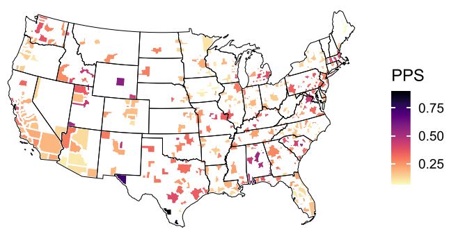 |
| Figure: The geographic variation of place level partisan segregation (PPS). [1] |
Using Ookami, the team analyzed anonymous GPS movement data for over 5 million points
of interest. The measurement of partisan segregation is done in two ways: (i) place-level
partisan segregation, which is based on the partisan composition of daily visitors,
and (ii) community-level experienced partisan segregation, which is based on the segregation
level of places visited by its residents.
The analysis showed partisan segregation in places varies across different geographic
areas, locations types, and time periods. Moreover, partisan segregation is distinct
from experienced segregation by race and income. The researchers found out that partisan
segregation individuals experience is relatively lower when they visit places beyond
their residential areas, but partisan segregation in residential space and activity
space is strongly correlated.
You can read more about this research in the publication Human mobility patterns are associated with experienced partisan segregation in US metropolitan areas.
[1] Zhang, Y., Cheng, S., Li, Z. , Jiang W.; Human mobility patterns are associated with experienced partisan segregation in US metropolitan areas. Sci Rep 13, 9768 (2023).